
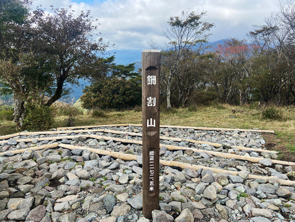
2020年10月21日(水)神奈川県の表丹沢にある鍋割山(1,273m)に行ってきました!今回の目的は、鍋割山の山頂にある鍋割山荘の名物「鍋焼きうどん」です。
今回はふらっとひとり登山です。大倉〜二俣〜越後乗越〜鍋割山のコースを単純往復するつもりでしたが、ボーッとしながら隣の塔ノ岳(1,491m)まで歩いてきました。
鍋割山には過去に何度が登っていますが、登山時期は「春」4月5月か、「秋」10月11月の季節に行くことが多いです。夏は暑いですし、ヒルの大量発生が怖くて、なかなか表丹沢には近寄れません。
この記事では、鍋割山のおすすめ登山コースを紹介します!登山初心者の友人を鍋割山に連れて行ったこともありますので注意点もぜひチェックしてください。便利な公共交通機関のアクセス方法や、温泉情報もまとめました!
鍋割山のおすすめ登山コース
鍋割山に登るコースはいくつかありますが、登山初心者向けコースと、健脚向けコースを紹介します。大倉登山口への便利なアクセス方法もご確認ください。
登山初心者向け「大倉〜二俣〜後沢乗越〜鍋割山」ピストン
初心者には、「大倉〜二俣〜後沢乗越〜鍋割山」のコースを往復することをおすすめします。
こちらのコースは、距離が16.63kmと長く、標高差も1000m近くありますので、初心者の中でも体力・脚力がある人向けです。
<コースタイムの目安:約6時間15分> 総距離16.63km/標高差982m
大倉(100分)→二俣(50分)→越後乗越(90分)→鍋割山 往路:3時間30分
鍋割山(50分)→越後乗越(40分)→二俣(100分)→大倉 復路:2時間45分
健脚向け「大倉〜鍋割山〜塔ノ岳周回コース」
健脚の人には、大倉から鍋割山(1,273m)と塔ノ岳(1,491m)と2座登頂するコースをおすすめします。
塔ノ岳に最初に登頂する逆コースもありですが、「鍋焼きうどん」を確実に食べたい人は、売り切れてしまう可能性があるので注意が必要です。
<コースタイムの目安:約8時間15分> 総距離17.64km/標高差1,201m
大倉(100分)→二俣(50分)→越後乗越(90分)→鍋割山 往路:4時間
鍋割山→塔ノ岳 1時間40分
塔ノ岳(30分)→花立山荘(65分)→駒止茶屋(60分)→大倉 2時間35分
大倉登山口へのアクセス
小田急線の渋沢駅から、神奈川中央バスに乗車して約15分で「大倉」に到着します。新宿からは、小田急線の急行に乗れば1時間10分ほどで渋沢駅に着くので、表丹沢は都心からのアクセスが良く手軽に登山できるところが魅力ですね!
バスの時刻表はこちら。朝〜夜までバスの本数も多いので安心です。
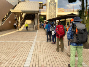
今回は、朝一のバスに乗車しましたが、平日でもこの混雑具合でした…!バスが2台出たので、全員乗車できました。乗車時間は短いので、座れなくてもここは我慢です。
電車・バスを利用する人は、小田急線の丹沢フリーパスを購入するとお得です!都内から目的地までの往復切符と、本厚木駅から渋沢駅までの列車、バス指定区間が乗り降り自由になります。AキップとBキップがありますが、今回のコースではBキップを選びます。
「丹沢フリーパス」Bキップの料金の一例です(2020年10月現在)
| 大人 | 子供 | |
| 新宿から | 1,560円 | 790円 |
| 新百合ヶ丘から | 1,220円 | 620円 |
| 町田から | 1,100円 | 560円 |
お土産屋さんや温泉施設なども、提携しているところは割引になります。
温泉施設では、小田急線の鶴巻温泉駅にある「弘法の里湯」や秦野駅にある「はだの富士見の湯」で使えますよ!
鍋割山で「鍋焼きうどん」を食べよう!
初心者向けコースも健脚向けコースも、往路は同じ道を歩いて鍋割山を目指します。山頂でおいしい鍋焼きうどんを食べた後、初心者は同じコースを下山します。
大倉登山口から鍋割山へ
大倉登山口に到着したら、まずはトイレと登山届の提出を済ませましょう。登山届の提出ボックスは、秦野ビジターセンター前にあります。
鍋割山の山頂までは約4時間の道のりですが、山頂までトイレはありません。
この日のバスにはたくさんの人が乗車していましたが、数名を残してほぼ全員塔ノ岳方面に向かっていきました。私は、今回の目的「鍋焼きうどん」がある鍋割山に一直線に向かいます!
のどかな住宅地を通り抜けて、鹿避けのネットをくぐり抜けたら、登山道に入ります。
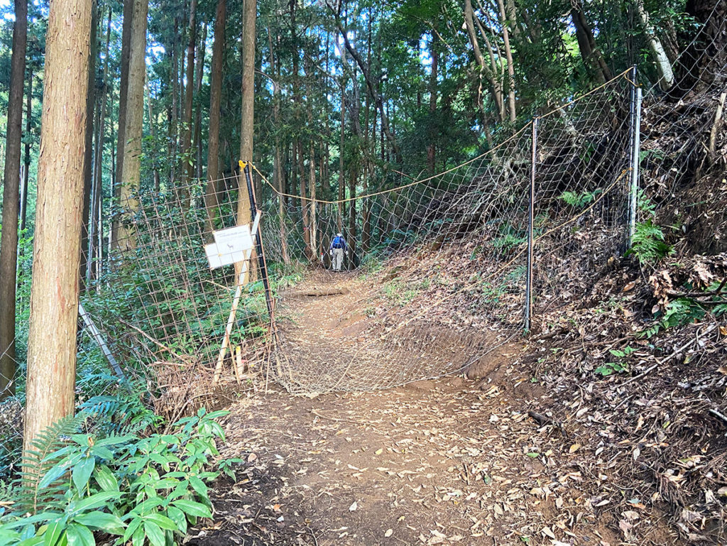
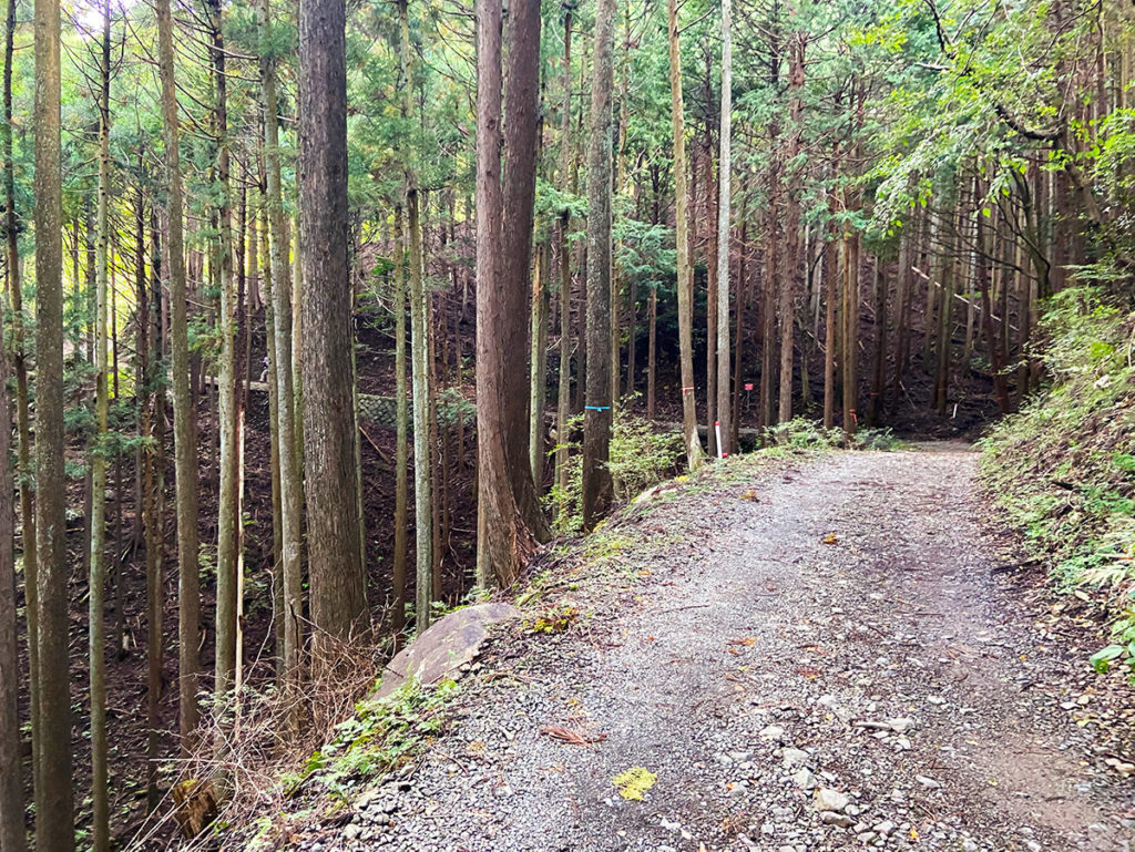
ここからは、ひたすら広くてなだらかな道を歩きます。
だらだらと長いので、友達と一緒に会話を楽しみながら歩くことをおすすめします。私はひとりだったので、悶々と考え事をしながら歩いていました。
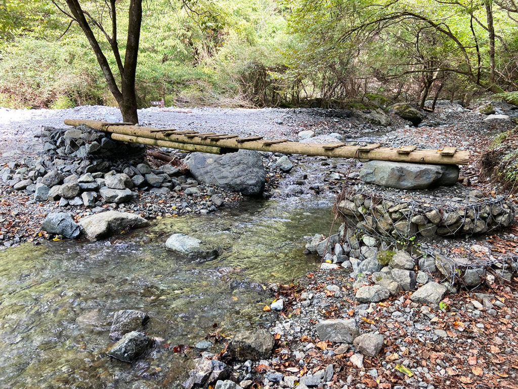
3箇所ほど沢を超えます。下のような橋がかかっているので安心ですが、増水時には要注意です。
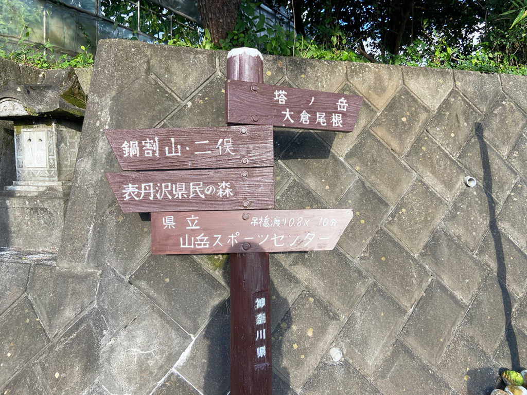
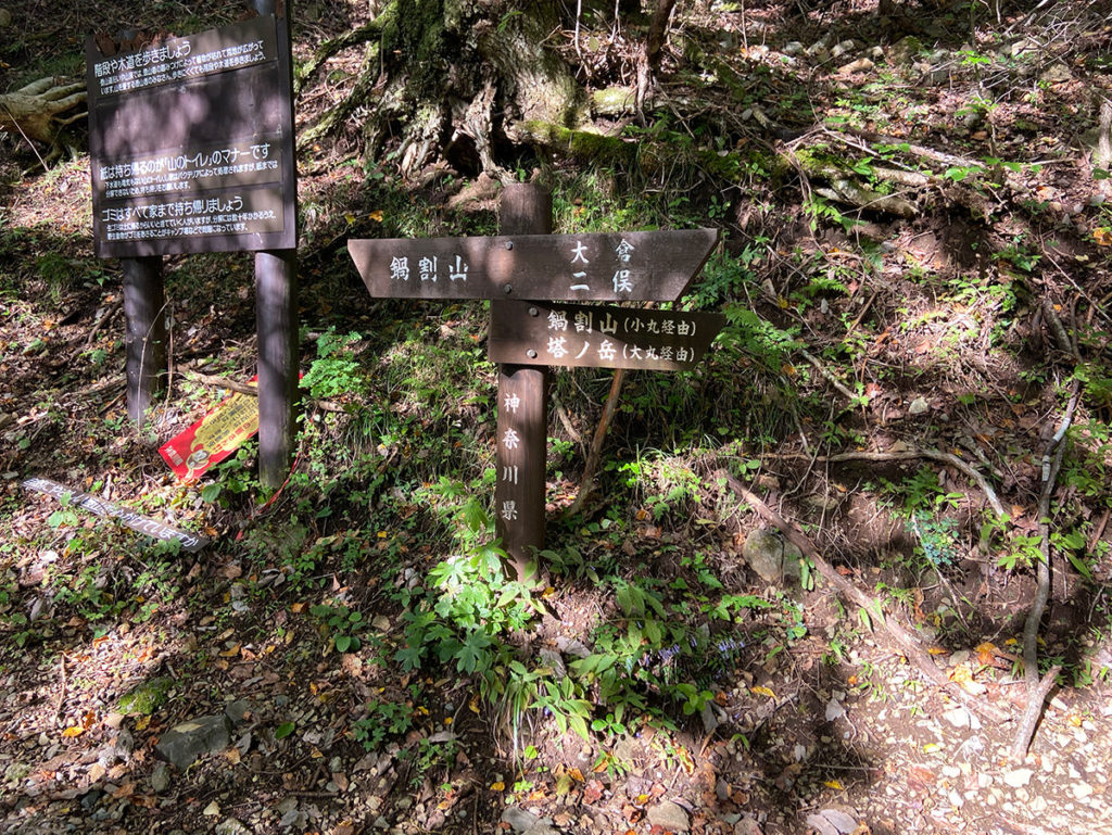
途中、二俣の分岐から小丸尾根を登って鍋割山に向かう登山道もありますが、少々わかりにくい道で、人も少ないのでおすすめしません。左の「鍋割山」と表示のある方面に進みます。
しばらく進むと、水の入ったペットボトルが積み上げられている場所に到着します。これは、鍋焼きうどんを作っている鍋焼き山荘が用意したもので、水を運ぶ歩荷のボランティアができます!私も2lのボトルを一本持ちました!
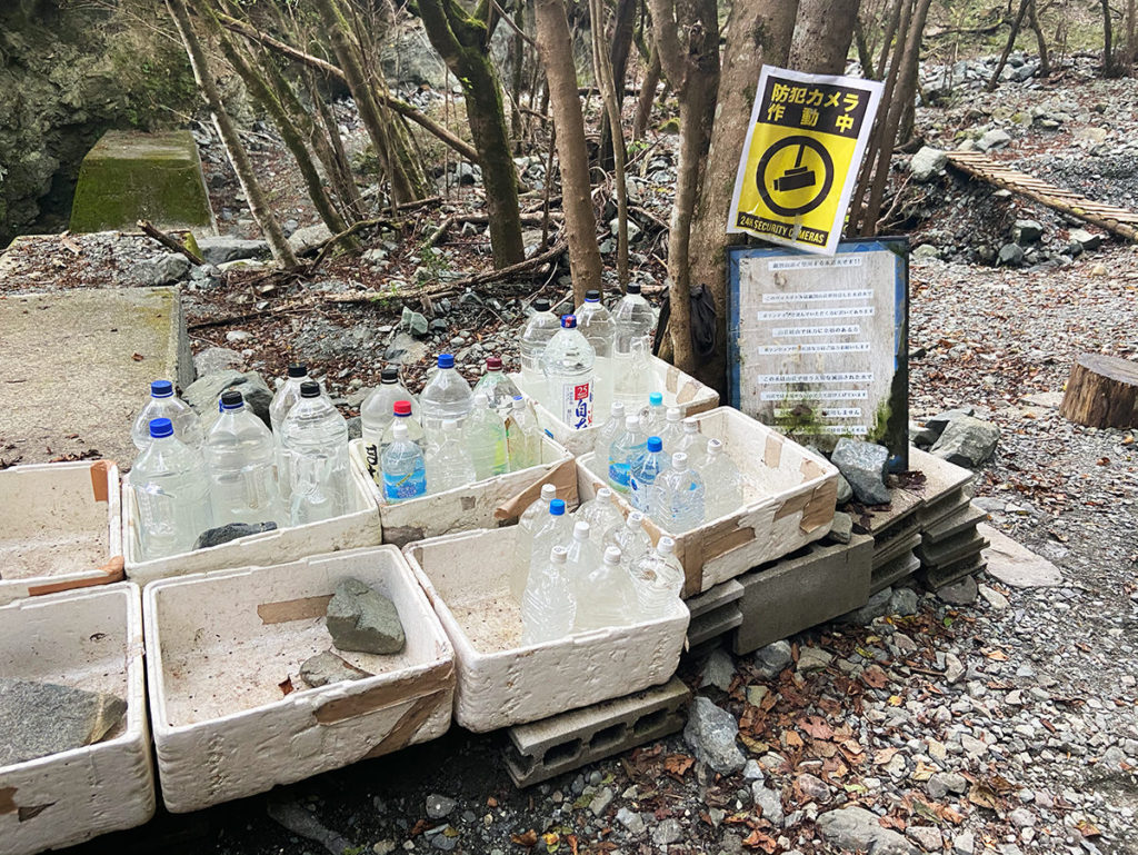
あくまでボランティアなので、体力の余力がある人のみ手伝いましょう。無理してケガをしたら、かえって迷惑をかけてしまいます。
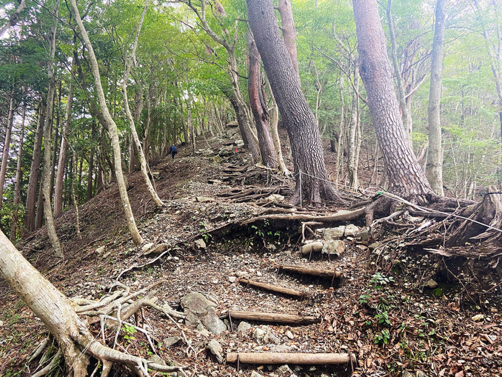
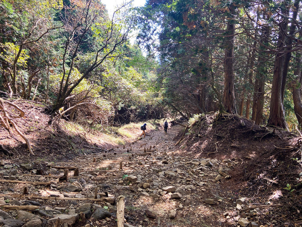
歩荷のボランティアをここで募るということは、ここからが許可車も入れないほどの急登が続くという意味でもあります。

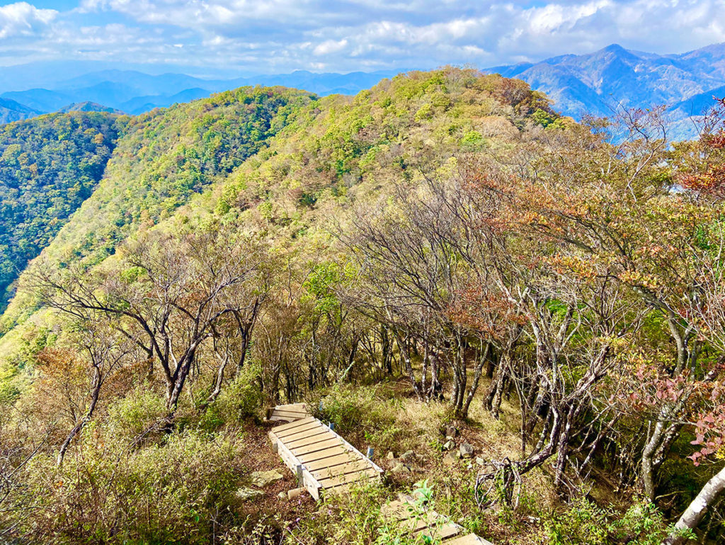
急登を後沢乗越(800m)の尾根まで登ったら、あとはひたすら鍋割山(1,273m)に向かって標高を上げながら尾根伝いに登っていきます。ここが地味に辛いです…!
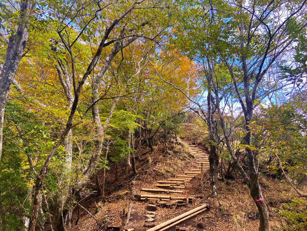
10月中旬ですが、山頂に近づくにつれて、秋らしく色づいてきました!
ついに鍋割山荘に到着!平日の小屋の営業は11時からですが、少し早く着いてしまったので休憩しながら待ちました。
今回は、平日+早い時間に到着したので、まだ数人しか人がいませんでした。10:40分頃からオーダー受付開始してくれました!
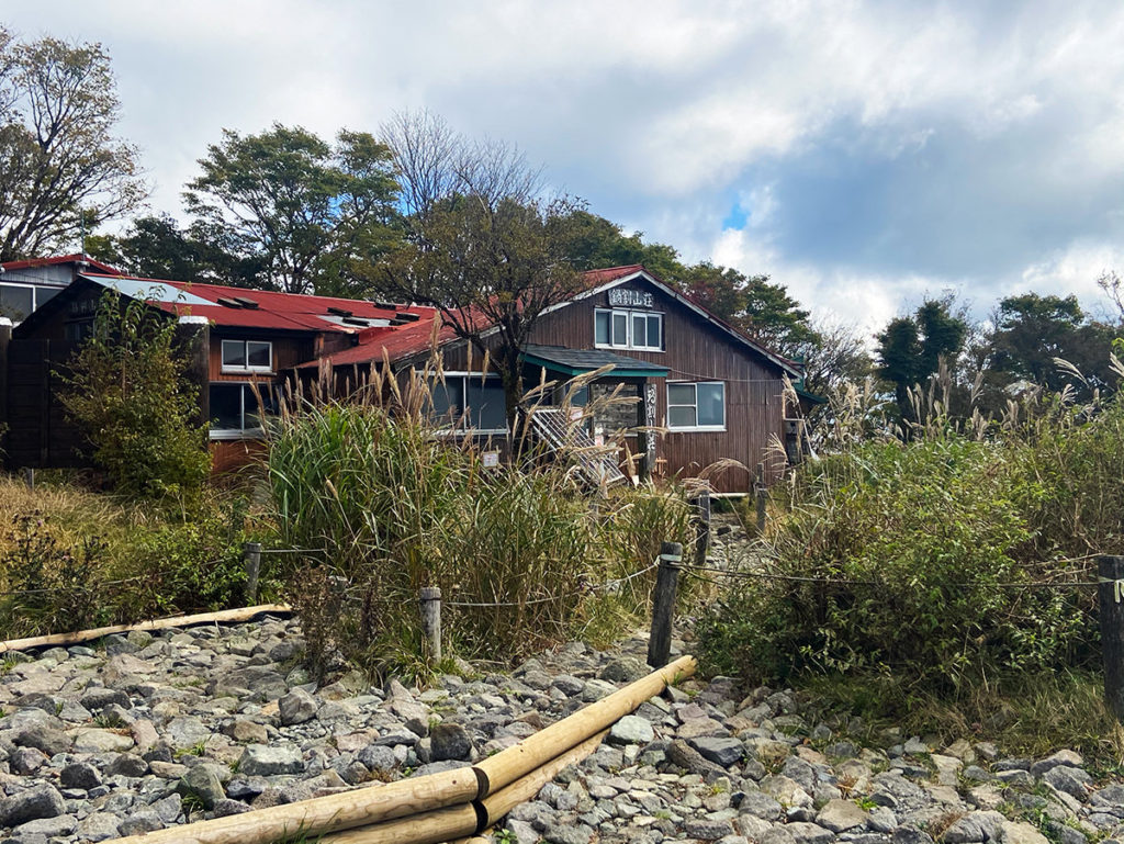
鍋割山荘のおじさんはちょっと怖い人と評判なので、怒鳴られてもあまり驚かないでくださいね。大人しく指示に従いましょう(笑)
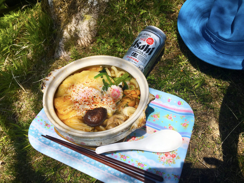
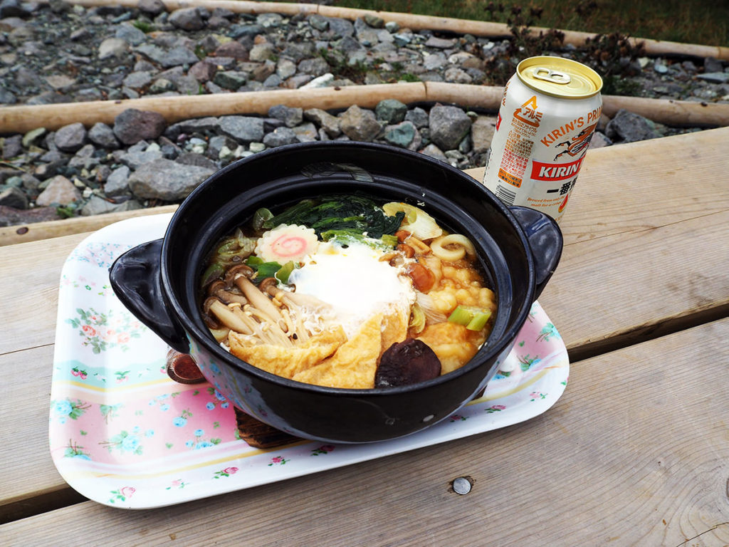
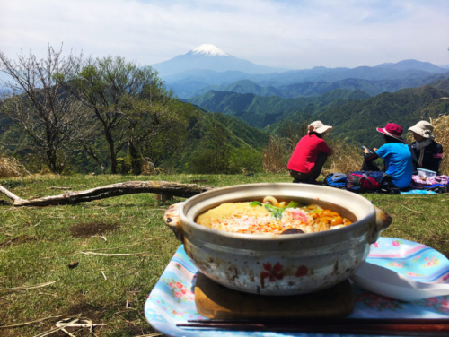
鍋焼きうどんは甘めの味付けでとってもおいしいです。疲れた体に沁みわたります。
鍋焼きうどんの注文は13時までですが、その前に売り切れになる日が多いそうです。せっかく登って食べられなかったら悲しすぎるので、早めに到着するスケジュールを組むことをおすすめします。
鍋割山荘の鍋焼きうどん(※詳細は必ず公式ホームページでご確認ください)
・鍋焼きうどんの価格:1,500円 ※ビールは500円でした!
・営業時間:平日11:00-13:00まで、休日10:00-13:00まで
・定休日:月曜日、金曜日
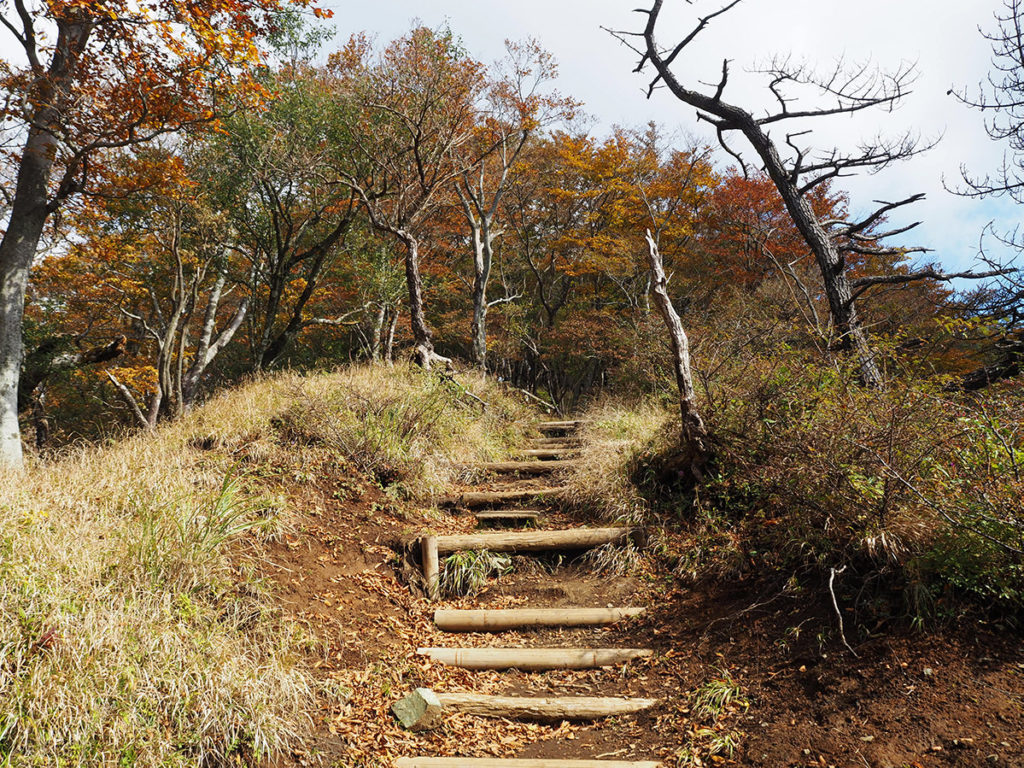
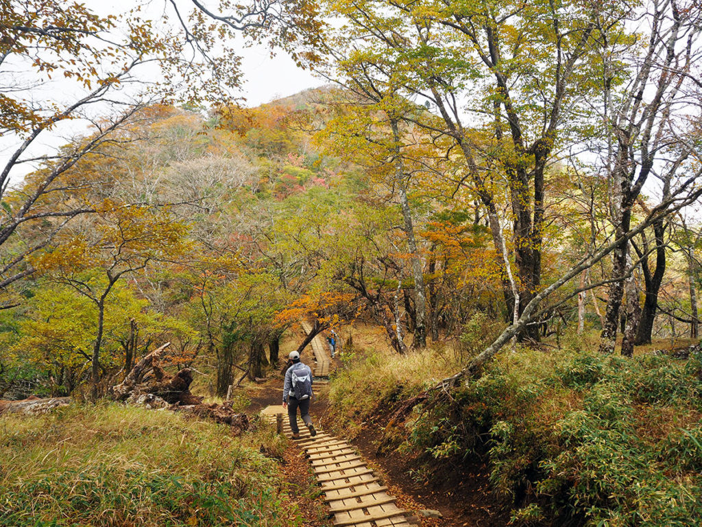
健脚コース:鍋割山から塔ノ岳へ【鍋割山稜を歩く】
まだ歩き足りない健脚派は、鍋割山陵を歩いて塔ノ岳を目指します!コースタイムで1時間40分の道のりです。
多少のアップダウンはありますが、危険箇所も無く、終始歩きやすい道が続きます。ここは景色を楽しめるルンルン登山コースです
大倉に下る分岐である金冷シを過ぎると、目の前に塔ノ岳が近づいてきます。よく眼を凝らすと山頂に人や建物も見えますよ。
この辺りはだいぶ秋色になってきました。
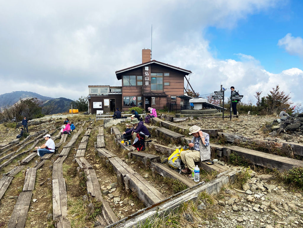
塔ノ岳山頂(1,491m)に到着しました!
山頂には尊仏山荘が立ち、天気に恵まれれば富士山や箱根の山々、南アルプス、奥秩父、八ヶ岳、房総半島まで見渡せる絶景が広がります。小屋前には広いスペースがあり、山ごはんを作って食べる人も目立ちます。
尊仏山荘には一度宿泊してみたいと思っています!富士山をバックに沈む夕日や、伊勢原や小田原の夜景がきれいだと評判です。
健脚コース:塔ノ岳から大倉まで下山【バカ尾根を歩く】

塔ノ岳から大倉登山口までは、大倉尾根をひたすら下ります。
目の前に相模湾を見渡しながら、空と海がキラキラしていてキレイ〜!と感動していましたが、次第にこれでもかというほどの長い階段の下りにうんざりしてきます(笑)
大倉尾根は別名「バカ尾根」と呼ばれていますが、その理由がよくわかりました。ここはストック必須ですね。個人的には、この坂は登りたくないなぁ。トレーニングには良さそうです!
花立山荘・堀山の家・駒止茶屋・見晴茶屋などの小屋が続き、休憩場所やトイレはこまめに設置されていました。下山道でケガをしてしまう人が多いので、ここはあせらずにゆっくりと下りました(まわりは早い人ばかりでしたが…。
14:30分頃にバスターミナルに到着、朝の7時から歩き始めたので長丁場でしたが、無事に下山しました。
まとめ:鍋焼きうどんを食べにまた来るだろうな
肌寒い季節になると、鍋割山で「鍋割うどん」が食べたくなります。今回は、いろいろと考え事をしていましたが、たくさん歩いて「鍋焼きうどん」を食べたら元気になりました!
予定していなかった、塔ノ岳まで歩くことになりましたが、特に鍋割山陵の尾根歩きが楽しかったです。秋の季節らしい紅葉も始まっていました。
丹沢は都心からのアクセスが良いところが魅力ですが、登りごたえのある山が多くあります。まだ山小屋に宿泊したことがないので、機会があれば丹沢主脈の縦走コース歩いてみたいなぁ…と思っています。
丹沢の紅葉シーズンは、標高にもよりますが11月上旬〜中旬頃がピークになるようです。これから、登山者も増えてくると思いますので、週末の混雑には注意して登ってみてください。
コメント